Impact Area
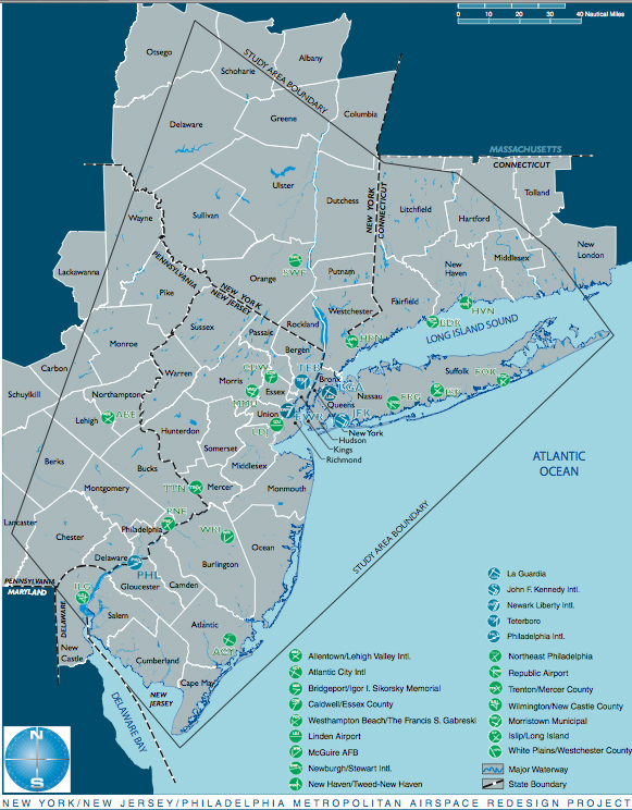
The Airspace Redesign involves a 31,000 square-mile, five-state area with a population of 29 million residents. Twenty-one airports are included within the project which began in 1998. This is the first major reconfiguratoin of Airspace in this area since the 1950's. You may view how Pound Ridge is affected here
Here are the Ground Routes Published Sept 19 2007
Impacted States
The FAA released images (scroll below to view) of phase 1 proposed flight paths to the public fairly early on in the project. Communities clearly effected under the inital plan were given impact studies and a 1 to 30 day public review and comment.
Since the release of these images and after select community review, the proposed flight paths were redesigned based on public comment and then re-presented as "Mitigated Preferred alternatives". Some communities were successful in pushing the proposed flight paths to the East or to the West, North or South. Many towns chose to push the flights from communities to parklands and open spaces to lessen for noise abatement. (see NJ's effort)
The "mitigated alternative" communities newly impacted were not awarded complete impact studies or adequate public review.
Below are the Phase 1 proposed flight paths. Go to the FAA website to view directly
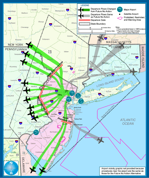
Newark Departures
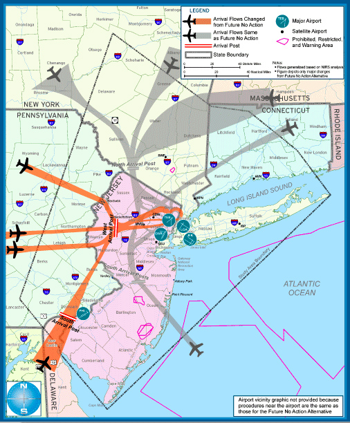
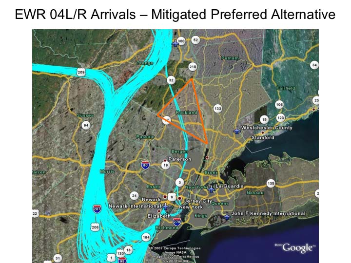
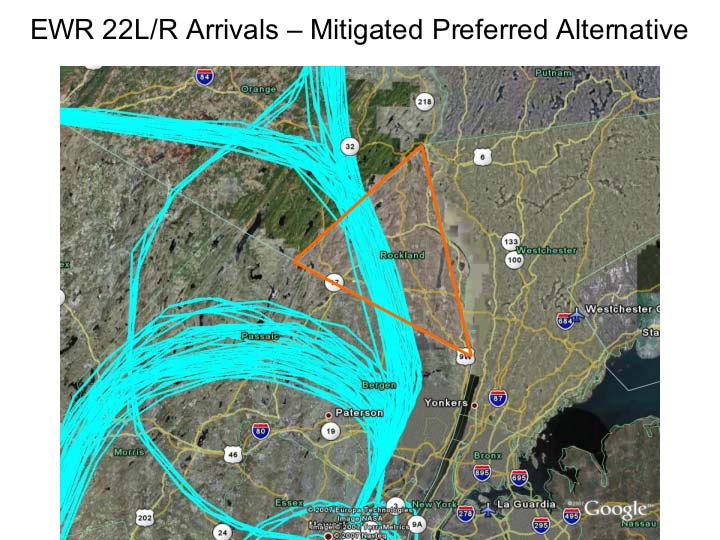
Newark Arrivals
Phase I design Teterboro Departures
Teterboro Arrivals
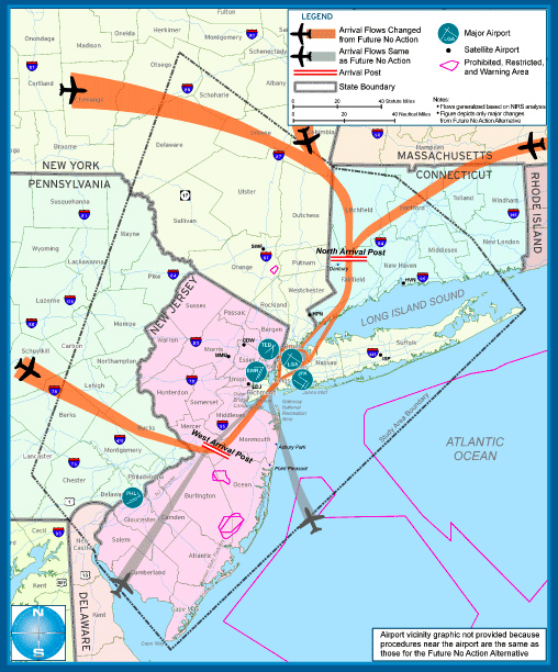
Laguardia Arrivals
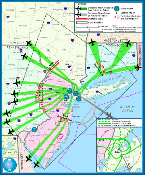
Laguardia Departures
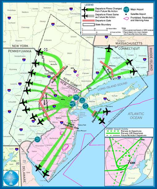
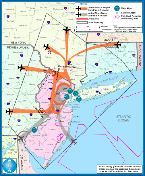
A Sample of Major changes
Here is a sample of how these "highways in the skies" will be changed. Some areas will suffer an introduction of 600 flights a day at varying altitudes. Other areas will experience heavy flight dispersion. The images below are the Newark New Jersey rerouting options considered. We are not certain on the final path selected by the FAA for implementation in January 2008. (image courtesy FAA Airspace Redesign documents which are public domain)
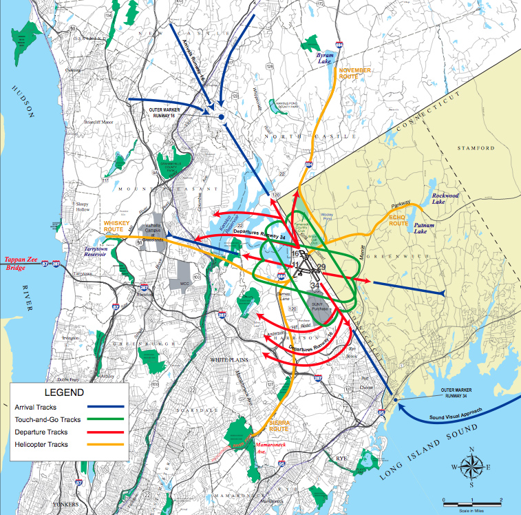
Here is a look at the current patterns at Westchester county Airport. According to the latest reports, the routes will be shifted to utilize Pound Ridge, New Canaan and Chappaqua airspace, though the final plan is uncertain. Some towns have been successful in pushing the flight paths to neighboring towns. (Ref. Westchester's Independant Environmental Impact study notes RE: Chappaqua, Greenwich)
According to First Selectman of New Canaan CT on New Canaan's Website,
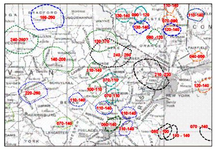
"New Holding Patterns Over Fairfield County, Orange County, and New York – Part of FAA Plan
Below is a diagram of the new holding-pattern for the Airspace Redesign released earlier this month as part of the Environmental Impact Statement. The holding pattern over New Canaan, Wilton and Weston is at 4,000 – 5,000 feet (the last two zeros are dropped for brevity.) The Red color indicates a holding pattern for Westchester County Airport, Black - JFK Arrivals and Blue - LGA Arrivals. Please note that the Holding Pattern over New Canaan, Wilton and Weston is the lowest of all the holding patterns in the four states of New Jersey, New York, Connecticut and Pennsylvania and will result in significant noise over our community. According to our Aviation Consultant departing flights from Westchester County will now be required to fly at 2,000 – 3,000 feet when the new holding pattern is in effect.
I encourage those of you who have not done so to sign our petition on the website opposing the new FAA plan."
Integrated Airspace Holding Pattern Configuration
Source: FAA—FEIS, Appendix N pp. 1192
OurAirspace
ourairspace.org
contact@OurAirspace.org
HOME | What to do | Legislation | Scientific Studies | Research | Solutions | Contact | About | News